PROACTIVE LAND STEWARDSHIP & WILDFIRE MITIGATION IN MONTANA
We help landowners throughout Western Montana and Northern Idaho protect their property,
restore ecological balance, and cultivate healthy, resilient forests for generations to come.
PROACTIVE LAND STEWARDSHIP & WILDFIRE MITIGATION IN MONTANA
We help landowners throughout Western Montana and Northern Idaho protect their property,
restore ecological balance, and cultivate healthy, resilient forests for generations to come.
Defending Your Land by Restoring Its Natural Balance
In Montana, fire is a natural part of the ecosystem. But overgrown, unmanaged land doesn't have to be. At Firestorm Forestry, we believe that effective land management is about much more than simply removing trees. It is about stewardship.
By strategically managing fuel loads, clearing invasive brush, and giving healthy trees the space they need to thrive, we create landscapes that are not only safer from the threat of catastrophic wildfire but also significantly more beautiful and ecologically sound. We bring the right equipment, the right strategy, and a deep respect for the land to every single project.

Comprehensive Forestry & Land Management Services in Western Montana and Northern Idaho
From precision tree care to heavy-duty land clearing, we have the specialized equipment and expertise
to handle acreage of any size.
Comprehensive Forestry & Land Management Services in Western Montana and Northern Idaho
From precision tree care to heavy-duty land clearing, we have the specialized equipment and expertise
to handle acreage of any size.
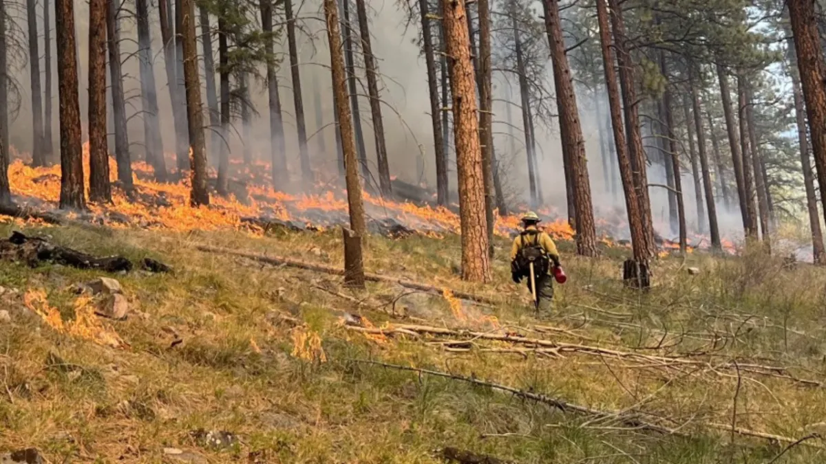
Wildfire Defense & Forest Health
• Wildfire Mitigation: Strategic reduction of ladder fuels and dense vegetation to keep ground fires from climbing into the forest canopy.
• Forestry Thinning: Selectively removing weaker or overcrowded trees to reduce competition, allowing the healthiest trees to access more water, sunlight, and nutrients.
• Forestry Cleanup: Removing deadfall, hazardous snags, and hazardous debris to leave your forest floor clean, accessible, and safe.
Heavy Forestry Operations
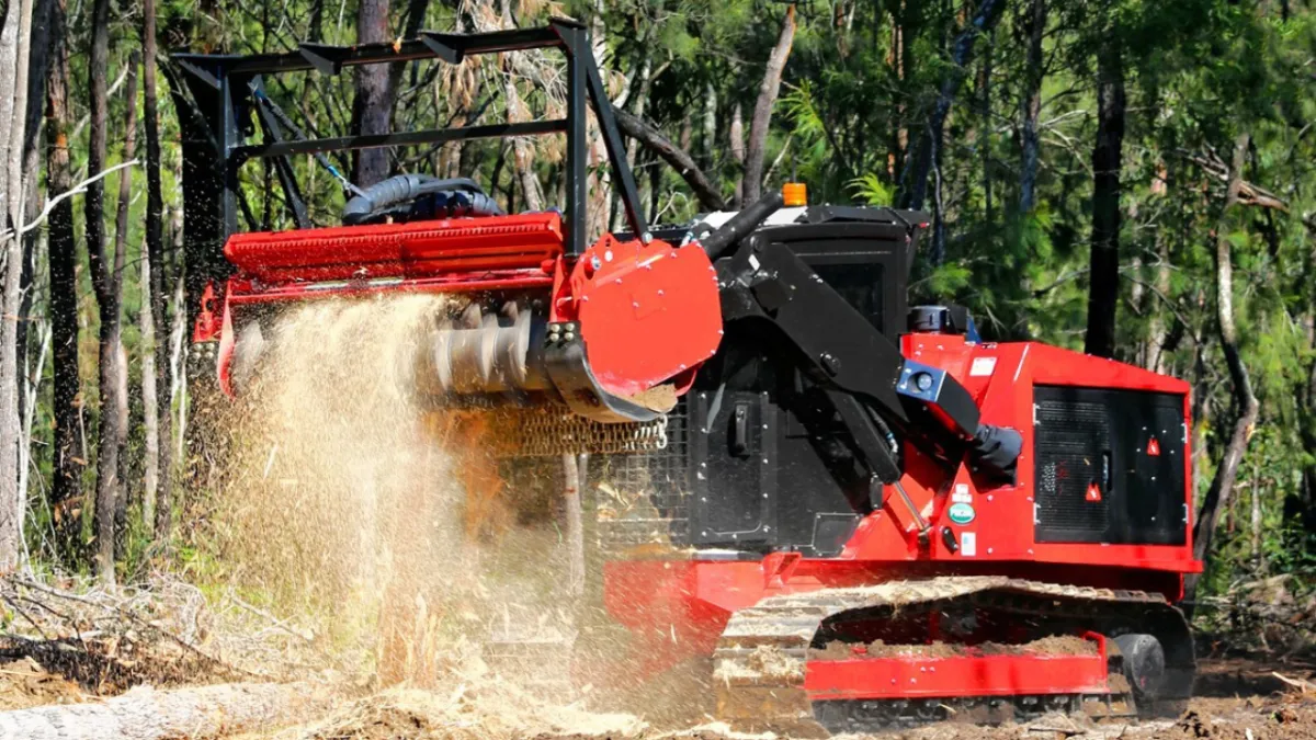
• Forestry Mulching & Mastication: Using cutting-edge machinery to grind brush, stumps, and small trees into mulch right where they stand. This highly efficient process completely eliminates the need to haul away debris while returning vital nutrients back to the soil.
• Whole Tree Chipping: Rapid, on-site processing of large trees and heavy timber into usable wood chips.
• Tree Removal: Safe, precision dismantling and removal of dead, dying, or hazardous trees.
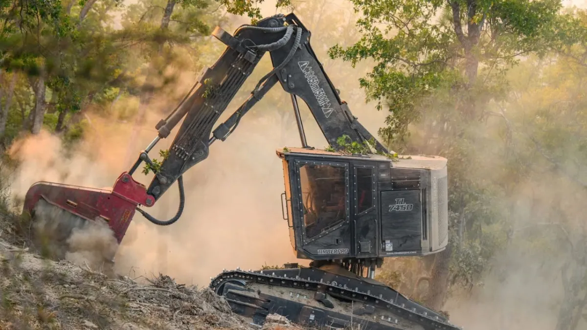
Land & Brush Management
• Land Clearing: Preparing your lot or acreage for new construction, pasture, or agricultural use.
• Brush Clearing: Eliminating dense, overgrown underbrush to reclaim usable land and improve property aesthetics.
• Right of Way Clearing: Creating clean, safe access corridors for driveways, utilities, fence lines, and roads.
• Ski Area Glading: Precision tree thinning and brush removal to create safe, enjoyable, and easily navigable off-piste ski runs.
Wildfire Defense & Forest Health
Wildfire Defense & Forest Health
• Wildfire Mitigation: Strategic reduction of ladder fuels and dense vegetation to keep ground fires from climbing into the forest canopy.
• Forestry Thinning: Selectively removing weaker or overcrowded trees to reduce competition, allowing the healthiest trees to access more water, sunlight, and nutrients.
• Forestry Cleanup: Removing deadfall, hazardous snags, and hazardous debris to leave your forest floor clean, accessible, and safe.
Heavy Forestry Operations
Heavy Forestry Operations
• Forestry Mulching & Mastication: Using cutting-edge machinery to grind brush, stumps, and small trees into mulch right where they stand. This highly efficient process completely eliminates the need to haul away debris while returning vital nutrients back to the soil.
• Whole Tree Chipping: Rapid, on-site processing of large trees and heavy timber into usable wood chips.
• Tree Removal: Safe, precision dismantling and removal of dead, dying, or hazardous trees.
Land & Brush Management
Land & Brush Management
• Land Clearing: Preparing your lot or acreage for new construction, pasture, or agricultural use.
• Brush Clearing: Eliminating dense, overgrown underbrush to reclaim usable land and improve property aesthetics.
• Right of Way Clearing: Creating clean, safe access corridors for driveways, utilities, fence lines, and roads.
• Ski Area Glading: Precision tree thinning and brush removal to create safe, enjoyable, and easily navigable off-piste ski runs.
A Simple, Consultative Approach
Every piece of land is unique. We partner with you to understand your specific goals for your property, ensuring the work we do today supports the health of your land tomorrow.

On-Site Assessment:
We walk your property with you, identifying potential fire hazards, forest health issues, and project requirements.


Custom Mitigation Plan:
We provide a clear, transparent scope of work. We educate you on our methods, the equipment we'll use, and exactly what you can expect the finished landscape to look like.

Professional Execution:
Our specialized crew arrives on time, works safely and efficiently, and treats your property with the utmost respect.
A Simple, Consultative Approach
Every piece of land is unique. We partner with you to understand your specific goals for your property, ensuring the work we do today supports the health of your land tomorrow.
On-Site Assessment:
We walk your property with you, identifying potential fire hazards, forest health issues, and project requirements.
Custom Mitigation Plan:
We provide a clear, transparent scope of work. We educate you on our methods, the equipment we'll use, and exactly what you can expect the finished landscape to look like.
Professional Execution:
Our specialized crew arrives on time, works safely and efficiently, and treats your property with the utmost respect.
Built for Montana's Toughest Terrain
Firestorm Forestry was founded on a commitment to preserving the beauty and safety of our local landscapes. Operating heavy machinery in complex forest environments requires more than just horsepower; it requires specialized knowledge, precision, and an unwavering commitment to safety.
Whether we are mulching acres of thick brush, carving out a new right-of-way, or executing a detailed wildfire mitigation plan around a family cabin, we utilize state-of-the-art forestry equipment. This allows us to work faster, leave a lighter footprint on the earth, and deliver exceptional results for our clients.
Service Areas
Western Montana
Flathead
A major tourism and residential hub; home to Kalispell and Whitefish. It features dense forests, high-end mountain estates, and is the gateway to Glacier National Park.
Missoula
The region’s primary urban center and home to the University of Montana. It is surrounded by steep, timbered hills and has a high population density at the forest edge.
Ravalli
Covering the Bitterroot Valley, this is a prime residential corridor. It's characterized by a mix of agriculture and sprawling forest-adjacent properties with high fire risk.
Lake
Primarily encompassing the Flathead Indian Reservation and Flathead Lake. The economy is driven by recreation, tourism, and fruit orchards along the shoreline.
Lewis and Clark
Home to the state capital, Helena. The geography transitions from the Great Plains into the Rocky Mountains, featuring significant residential areas in timbered foothills.
Silver Bow
Centered on Butte; an urban-industrial county with a deep mining history. The landscape is rugged, featuring a mix of high-desert and mountainous terrain.
Deer Lodge
Historically tied to the smelting industry (Anaconda). It is a mountainous county with significant forest acreage and a growing recreation sector.
Lincoln
Located in the state's NW corner (Libby). It is heavily forested and rugged, with an economy traditionally built on the timber and mining industries.
Sanders
A rural, mountainous county along the Clark Fork River. It is known for its dramatic scenery, low population density, and extensive federal forest lands.
Powell
Features a mix of large cattle ranches and high-mountain timber. It is home to the Deer Lodge valley and significant wilderness access points.
Granite
A quiet, mountainous county known for sapphire mining and the historic town of Philipsburg. It has many seasonal cabins and high-elevation forests.
Mineral
A narrow, rugged county following the I-90 corridor. It is almost entirely mountainous and forested, with very few developed towns but high transit traffic.
Glacier
Borders the Canadian line and contains the Blackfeet Reservation. The western half is alpine (Glacier NP), while the east is mostly open high plains.
Northern Idaho
Kootenai
The economic powerhouse of the Panhandle (Coeur d'Alene). It is one of the fastest-growing areas in the NW, with heavy development into forested hillsides.
Bonner
Centered on Sandpoint and Lake Pend Oreille. A premier four-season recreation destination with a high concentration of high-value lakefront and mountain homes.
Latah
Home to Moscow and the University of Idaho. It features "The Palouse" (rolling hills) to the west and transitions into thick timbered mountains to the east.
Nez Perce
Centered on Lewiston at the confluence of the Snake and Clearwater rivers. It is an industrial and transportation hub with significant canyon-land terrain.
Shoshone
Known as the "Silver Valley." It is extremely steep and mountainous, with a history of silver mining and a current focus on mountain recreation and timber.
Idaho
The state's largest county by area. It is incredibly vast and rugged, containing several major wilderness areas and massive stretches of navigable timber.
Boundary
The northernmost county, bordering Canada. It is defined by the Kootenai River Valley and is heavily reliant on agriculture and timber production.
Clearwater
A remote and heavily forested county (Orofino). It is home to the Dworshak Dam and Reservoir and is a major center for logging operations.
Benewah
Located on the Coeur d'Alene Reservation. The landscape is dominated by the St. Joe River and dense forests; the economy is primarily timber-based.
Lewis
A small, rural county on the Camas Prairie. It is largely agricultural with forested canyons, serving as a quiet, tight-knit community hub.
Ready to Protect and
Improve Your Land?
Reach out today to schedule your site assessment.
Ready to Protect and Improve Your Land?
Reach out today to schedule your site assessment.



Serving Western Montana and Northern Idaho